Lislefjødd
| Marking: |  |
Difficulty: | Medium |
| Distance: | 2.9 km | Status: | Closed |
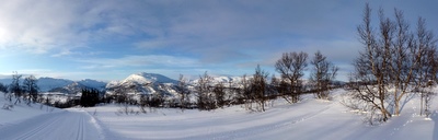

Lislefjødd ski track
Foto: Jan Mielke
Foto: Jan Mielke
Back to the overview map
Track statististics
| Altitude difference: | 83 m | ||
| Lowest point: | 887 m | Highest point: | 970 m |
| Vertical meters up: | 83 m | Vertical meters down: | 82 m |
| Steepest up: | 17.6 % | Steepest down: | 20 % |
| Longest up: | 1891 m | with a altitude difference of 83 m | |
| Longest down: | 956 m | with a altitude difference of 82 m | |
| Incline/Decline | >15% | 10% - 15% | 5% - 10% |
| Up | 169 m | 229 m | 254 m |
| Down | 155 m | 256 m | 248 m |
| Plane (±5%) | 1571 m |