Lysløype sentrum
| Markierung: |  |
Schwierigkeit: | Leicht |
| Länge: | 3.5 km | Status: | Geschlossen |
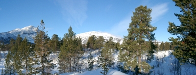

Blick von der Gamel Lysløype-Loipe in Richtung des Berges Nos
Foto: Jan Mielke
Foto: Jan Mielke
Zurück zur Übersichtskarte
Loipenstatistik
| Höhendifferenz: | 65 m | ||
| Niedrigst. Punkt: | 760 m | Höchst. Punkt: | 825 m |
| Höhenmeter aufwärts: | 72 m | Höhenmeter abwärts: | 30 m |
| Steilst. aufwärts: | 20 % | Steilst. abwärts: | 25 % |
| Längst. aufwärts: | 1990 m | mit einer Höhendiff. von 63 m | |
| Längst. abwärts: | 1274 m | mit einer Höhendiff. von 24 m | |
| Steigung/Gefälle | >15% | 10% - 15% | 5% - 10% |
| Aufwärts | 5 m | 51 m | 291 m |
| Abwärts | 15 m | 87 m | 141 m |
| Eben (±4%) | 2907 m |