Maurliflotti
| Markierung: |  |
Schwierigkeit: | Mittel |
| Distanz: | 5.4 km | Status: | Geschlossen |
| Rundloipe: | nein |
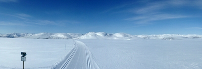

Am Kreuz der Øvre Badstogsdalen- und der Geiskeli-Loipe
Foto: Jan Mielke
Foto: Jan Mielke
Zurück zur Übersichtskarte
Loipenstatistik
| Höhendifferenz: | 165 m | ||
| Niedrigst. Punkt: | 978 m | Höchst. Punkt: | 1143 m |
| Höhenmeter aufwärts: | 180 m | Höhenmeter abwärts: | 34 m |
| Steilst. aufwärts: | 9.4 % | Steilst. abwärts: | 9.9 % |
| Längst. aufwärts: | 1976 m | mit einer Höhendiff. von 103 m | |
| Längst. abwärts: | 758 m | mit einer Höhendiff. von 7 m | |
| Steigung/Gefälle | >15% | 10% - 15% | 5% - 10% |
| Aufwärts | 0 m | 208 m | 1581 m |
| Abwärts | 25 m | 0 m | 283 m |
| Eben (±5%) | 3266 m |