Vidmyr
| Markering: |  |
Nivå: | Lett |
| Distanse: | 6.2 km | Status: | Stengt |
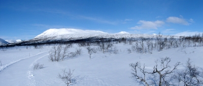

Utsikt fra Vidmyr løypa mot Nos
Foto: Jan Mielke
Foto: Jan Mielke
Tilbake til oversiktskart
Løypestatistikk
| Høydeforskjell: | 90 m | ||
| Laveste punkt: | 811 m | Høyeste punkt: | 901 m |
| Høydemeter oppover: | 112 m | Høydemeter nedover: | 112 m |
| Bratteste oppover: | 9.8 % | Bratteste nedover: | 10.6 % |
| Lengste oppover: | 1796 m | med en høydeforskell av 64 m | |
| Lengste nedover: | 1408 m | med en høydeforskell av 90 m | |
| Stigning/Fall | >15% | 10% - 15% | 5% - 10% |
| Oppover | 22 m | 202 m | 769 m |
| Nedover | 54 m | 290 m | 654 m |
| Flatt terreng (±5%) | 4191 m |